
Air pollution levels deemed hazardous to health have been recorded in Hua Hin and nearby districts of Prachuap Khiri Khan for several days, prompting concerns among residents and health authorities.
On Thursday, the Prachuap Khiri Khan Provincial Health Office shared data indicating that air quality had reached amber or orange levels across all eight districts in the province.
 Subscribe to the Hua Hin Today newsletter for the latest news, information and events from Hua Hin delivered to your inbox

 SUBSCRIBE
According to the latest air quality report issued at 9 a.m. on 9 January 2025, PM2.5 levels—a key indicator of fine particulate matter—were as follows:
- Hua Hin: 59.2 µg/m³
- Pranburi: 64.0 µg/m³
- Sam Roi Yot: 72.1 µg/m³
- Kui Buri: 75.9 µg/m³
- Mueang Prachuap: 77.8 µg/m³
- Thap Sakae: 75.7 µg/m³
- Bang Saphan: 72.1 µg/m³
- Bang Saphan Noi: 62.8 µg/m³
At Hua Hin’s monitoring station, air quality was measured at 39.2 µg/m³. While this falls within a moderate range, PM2.5 readings in several other districts were approaching unhealthy levels, where the potential health impact becomes more significant.

Air quality and health concerns
The air quality index categorises PM2.5 levels above 37.6 µg/m³ as having potential health impacts. Levels above 75.1 µg/m³ are considered unhealthy.
Exposure to elevated PM2.5 levels can cause various symptoms, including eye irritation, respiratory discomfort, and skin problems.
Residents are advised to take precautions, particularly vulnerable groups such as children, the elderly, and those with pre-existing respiratory conditions.
Identifying the source of the pollution
The Geo-Informatics and Space Technology Development Agency (GISTDA) has reported that much of the air pollution can be traced to hotspots—areas where agricultural and forest fires are burning. Satellite data collected on 8 January 2025 revealed 328 hotspots across Thailand, with Nakhon Ratchasima (Korat) recording the highest number of 24 hotspots.
Breakdown of hotspots by land type in Thailand:
- Agricultural land: 138 hotspots
- Land reform zones: 72 hotspots
- National forest reserves: 70 hotspots
- Community and other areas: 31 hotspots
- Conservation forests: 13 hotspots
- Roadside areas: 4 hotspots
Neighbouring countries were found to have contributed to the region’s air pollution, with Cambodia reporting 1,004 hotspots, followed by Vietnam with 196, Myanmar with 152, Laos with 113, and Malaysia with 19.
Authorities are urged to manage affected areas and mitigate further pollution by controlling agricultural burning and other contributing factors.
For more information on current air quality readings, residents can visit the official Air4Thai website or access data from GISTDA’s PM2.5 monitoring platform.
Local health offices also recommend wearing masks outdoors and avoiding prolonged exposure to the polluted air.
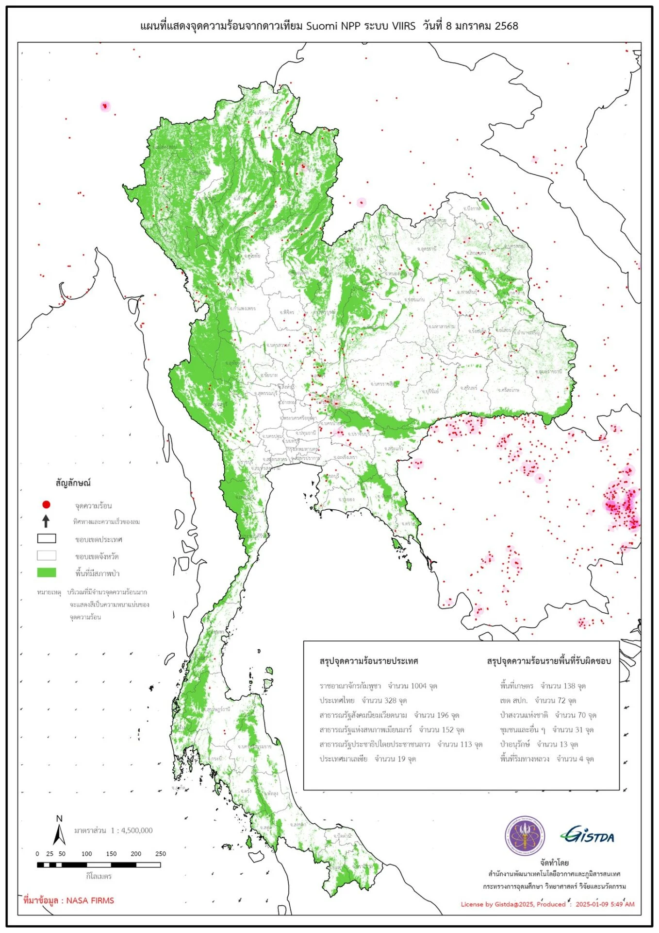
Geo-Informatics and Space Technology Development Agency (GISTDA) graphic on burning hotspots in and around Thailand on Thursday 9 Jan, 2025.